


Baldwin County PUMA, Alabama
About
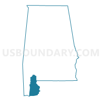
Outline

Summary
| Unique Area Identifier | 192108 |
| Name | Baldwin County PUMA |
| State | Alabama |
| Area (square miles) | 2,027.31 |
| Land Area (square miles) | 1,589.78 |
| Water Area (square miles) | 437.53 |
| % of Land Area | 78.42 |
| % of Water Area | 21.58 |
| Latitude of the Internal Point | 30.65921830 |
| Longtitude of the Internal Point | -87.74606660 |
Maps

Graphs
Select a template below for downloading or customizing gragh for Baldwin County PUMA, Alabama


Neighbors
Neighoring Public Use Microdata Area (by Name) Neighboring Public Use Microdata Area on the Map
- Escambia County (North) PUMA, FL
- Escambia County (South) PUMA, FL
- Mobile City (East) PUMA, AL
- Mobile County (Outer)--Prichard City, Tillmans Corner & Saraland City PUMA, AL
- Southwest Alabama PUMA, AL
Top 10 Neighboring County (by Population) Neighboring County on the Map
- Mobile County, AL (412,992)
- Escambia County, FL (297,619)
- Baldwin County, AL (182,265)
- Escambia County, AL (38,319)
- Clarke County, AL (25,833)
- Monroe County, AL (23,068)
- Washington County, AL (17,581)
Top 10 Neighboring County Subdivision (by Population) Neighboring County Subdivision on the Map
- Mobile CCD, Mobile County, AL (236,809)
- Pensacola CCD, Escambia County, FL (232,756)
- Cantonment CCD, Escambia County, FL (50,638)
- Foley CCD, Baldwin County, AL (48,089)
- Daphne CCD, Baldwin County, AL (41,295)
- Fairhope CCD, Baldwin County, AL (25,894)
- Robertsdale CCD, Baldwin County, AL (24,317)
- Bay Minette CCD, Baldwin County, AL (23,604)
- Theodore CCD, Mobile County, AL (23,380)
- Atmore CCD, Escambia County, AL (12,372)
Top 10 Neighboring Place (by Population) Neighboring Place on the Map
- Mobile city, AL (195,111)
- Daphne city, AL (21,570)
- Fairhope city, AL (15,326)
- Foley city, AL (14,618)
- Gulf Shores city, AL (9,741)
- Bay Minette city, AL (8,044)
- Spanish Fort city, AL (6,798)
- Orange Beach city, AL (5,441)
- Robertsdale city, AL (5,276)
- Point Clear CDP, AL (2,125)
Top 10 Neighboring Unified School District (by Population) Neighboring Unified School District on the Map
- Mobile County School District, AL (399,587)
- Escambia County School District, FL (297,619)
- Baldwin County School District, AL (182,265)
- Escambia County School District, AL (32,911)
- Monroe County School District, AL (23,068)
- Clarke County School District, AL (19,941)
- Washington County School District, AL (17,581)
Top 10 Neighboring State Legislative District Lower Chamber (by Population) Neighboring State Legislative District Lower Chamber on the Map
- State House District 1, FL (159,402)
- State House District 2, FL (139,453)
- State House District 95, AL (61,642)
- State House District 94, AL (59,763)
- State House District 102, AL (50,860)
- State House District 96, AL (50,198)
- State House District 105, AL (44,279)
- State House District 66, AL (40,491)
- State House District 64, AL (40,427)
- State House District 65, AL (38,681)
Top 10 Neighboring State Legislative District Upper Chamber (by Population) Neighboring State Legislative District Upper Chamber on the Map
- State Senate District 2, FL (449,902)
- State Senate District 4, FL (433,628)
- State Senate District 32, AL (155,619)
- State Senate District 22, AL (137,373)
- State Senate District 35, AL (126,686)
- State Senate District 33, AL (111,915)
Top 10 Neighboring 111th Congressional District (by Population) Neighboring 111th Congressional District on the Map
- Congressional District 1, FL (694,158)
- Congressional District 1, AL (687,841)
- Congressional District 7, AL (603,352)
Top 10 Neighboring Census Tract (by Population) Neighboring Census Tract on the Map
- Census Tract 107.03, Baldwin County, AL (13,166)
- Census Tract 114.01, Baldwin County, AL (10,632)
- Census Tract 115.02, Baldwin County, AL (10,534)
- Census Tract 114.03, Baldwin County, AL (9,131)
- Census Tract 111.01, Baldwin County, AL (8,397)
- Census Tract 107.05, Baldwin County, AL (8,331)
- Census Tract 109.05, Baldwin County, AL (8,011)
- Census Tract 107.01, Baldwin County, AL (7,882)
- Census Tract 103, Baldwin County, AL (7,826)
- Census Tract 57, Mobile County, AL (7,182)
Top 10 Neighboring 5-Digit ZIP Code Tabulation Area (by Population) Neighboring 5-Digit ZIP Code Tabulation Area on the Map
- 32526, FL (36,297)
- 32506, FL (33,846)
- 32507, FL (28,996)
- 36526, AL (27,890)
- 36532, AL (27,829)
- 36535, AL (26,767)
- 32533, FL (26,493)
- 36507, AL (19,090)
- 36502, AL (18,355)
- 36542, AL (12,705)